SURVEYING

Topographical survey, drone survey and inspection, Terrestrial & Aerial LIDAR
DIGITAL CARTOGRAPHY

Topographic, Thematic, Navigational & Environmental Maps. 3D Cartography
GEOSPATIAL ANALYSIS
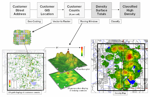
Data Classification , Geoprocessing workflows, Deep learning
BUILDING INFORMATION MODELLING
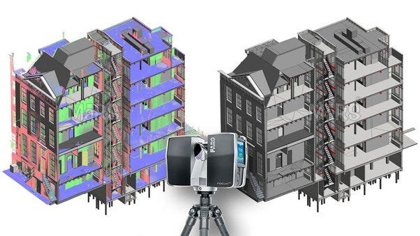
Scan to BIM, CAD to BIM, Revit MEP modelling, Facility management information
FTTH
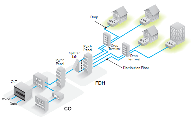
Infrastructure surveys, Feasibility, Optical network design and dimensioning, As-built design & database update, Permit management
STRUCTURAL ANALYSIS & DESIGN

Structural analysis & design. Structural detailing & drafting. 3D modelling & stimulation
We Follow Best Practices
Request a Quote
Ready to Work Together? Build a project with us!